Empty perfection can still be found in one of the most crowded corners of the earth. The question is are you willing to pay the price of admission?
Let me start by explaining the fact that I have a few screws loose when it comes to conventional thinking. I also have the drive, determination and retard reasoning to allow for my stupid whims to be seen through to fruition. As a result a day as I am about to describe to you is a normal occurrence in the life of Chris Lisanti. If you happen to be friends with me and have a sense of adventure you may find yourself biting off more then you can chew as my boy Mike found out the hard way.
My morning started out as any other day of waves does except a little earlier. I had noticed with the current Santa Anna Winds and solid combo swell that it may be a perfect Jalama day. My friend Mike was fresh off a Bali surf excursion and was pumped to keep the surf ball rolling. On board for a sick day of surfing the plan was to meet at my place at 7 am a cruise from there. I was even awoken from my slumber by a Jalama dream.
In the dream I was checking out where I wanted to surf from the usual cliff above the camp ground where I can see for miles in either direction with my binoculars. The scene was just perfect. Lefts marching down the beach in graceful harmony as glassy as could be. The sun was rising thus lighting up everything in beautiful reds, yellows, purples and orange. It was surreal. Then all of a sudden I slipped and fell off the cliff. I caught myself with my feet at the edge and was dangling upside down. Luckily my dad was there to rescue me (my dad lives in Jersey). That’s when I woke up conveniently at 6:30 am. Crazy huh?
I’m not one to analyze dreams or anything, but I am sure there is all kinds of hidden meanings in that one. I would also like to note that it is rare that I have a dream I remember. It’s a good thing for it though cause I forgot to set an alarm on my phone and would have totally over slept. I fed my cats among other morning pre-surf chores just as Mike showed up. We loaded up the Civic and were off.

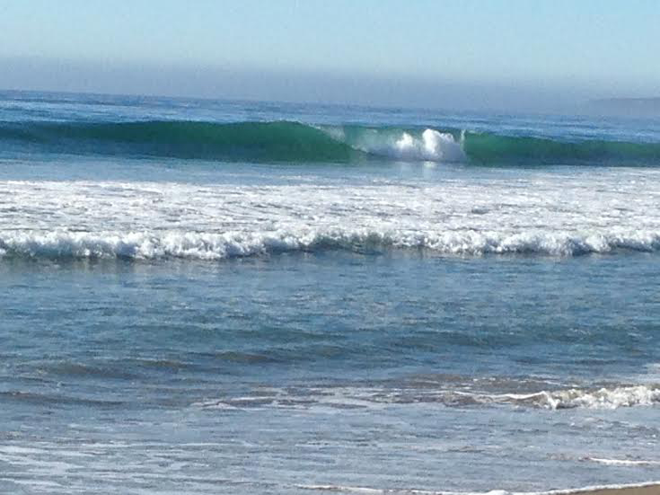
When Jalama is on it can be a pure surfing bliss!
Whenever I head up to Jalama I always stop at the Market Bagel Cafe for some bagels up on the Mesa. It may be the best bagel in Santa Barbara. Just don’t get scrambled eggs there. The cook always lets them oxidize in the holding pan and are almost always green. I have been cooking and holding large quantities of scrabbled eggs for years and have never ending up with them turning green. To each their own. Maybe they are just really big Dr. Seuss fans.
Whenever I go with a bud whoever is not driving buys the bagels. Mike ponied up to the counter and paid. As we were leaving another customer stopped him and handed him a dollar off the floor that he claimed Mike had dropped. Mike took it and said “This is our lucky dollar today”. I am not really a superstitious person by any means though the dollar did change the routine and may have been ultimately the jinx.
We had an easy and uneventful drive up to the Jalama turn off at the PCH 1 while Mike told me of all his Bali stories from the past month. Not even a mile into the Jalama road taped over the camping status sign was “Jalama Beach CLOSED”! CLOSED!!! WTF!!!. I slammed on the breaks and threw it into reverse to have a better look. Sure enough there was an orange construction sign explaining that the park was closed till May 3rd for renovation. Normally with most parks this is not an issue. The majority of the time I park outside the park area and walk in to avoid paying the parking fees. At Jalama that is not an option since all the possible spots to park are tow away zones and you do not want to even deal with that situation in such a remote area.
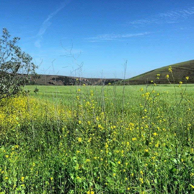
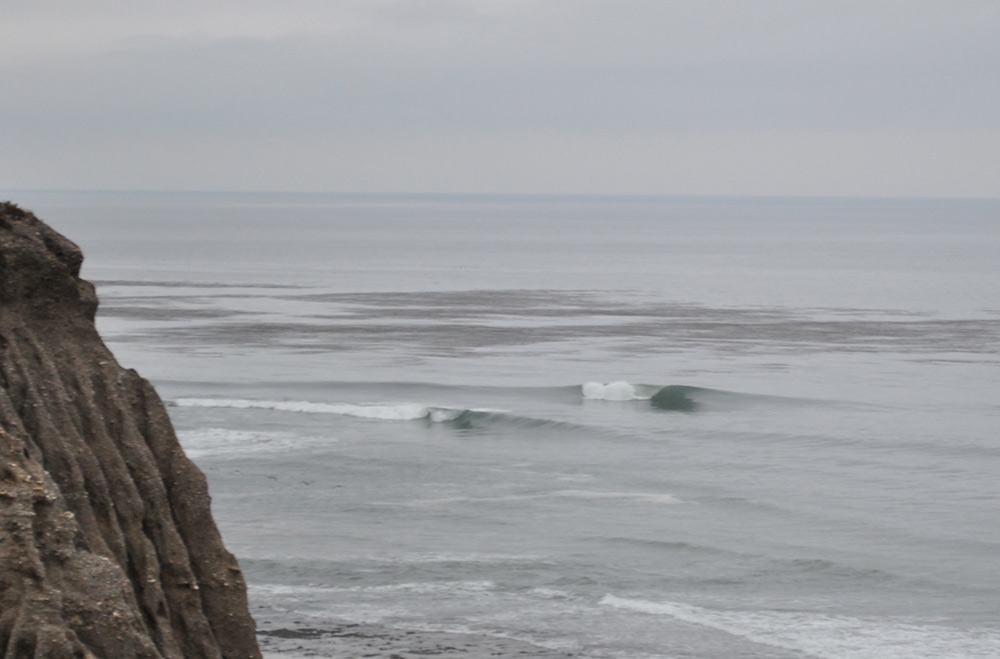
This is what pretty much the entire coast line north of Point Conception looks like for 100 miles at least. One word: Remote…
Pissed the gears in my head start turning on what our next move should be. Truthfully around Point Conception there are not many options. Either access is near to impossible due to private property or worse military, or its a gnarly closed out sharky beach break or both. The winds were off shore and I really did not want to drive all the way back to Ventura and surf the same old crowded spots I always surf. Then I thought, what about the Guadaloupe Dunes, between the dunes themselves and the river mouth there is always alright banks up and down the beach. There was plenty of swell, too much even.

The large sandy area in the distance is the southern most end of the Guadalupe Dunes.
We agreed to give it a go and make lemonade out of lemons. On the way up, not having been there since 2012 with Pat I made a wrong turn and got a bit lost (check out the blog I wrote about the session in 2012 “Lemonade out of Lemons” Here.). Mike pulled up our GPS on Google Maps and it appeared I was a few miles off on my judgement of where the westerly road to the Dunes was. As we were looking at the map on his phone I noticed that there was a Point Sal State Park. I have been staring at Point Sal on the map for years wondering about its surf-ability and access. I always thought it was part of Vandenberg and there for inaccessible from land. If a state park did exist then there must be access to it some where or what would be the point of having a park there.
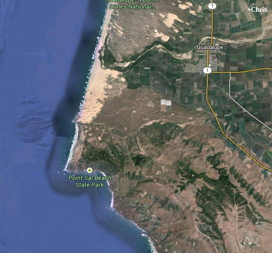
The Google Earth Map of Point Sal that had my interest peaked. Notice the lack of roads leading to it…Also take note of the rugged terrain.
Keen on finding a new spot and some surf adventure we set out in search of this magical place. All the roads we hit that should take us to the park were closed. Mostly because they ran through Vandenberg. Others because they had sustained too much damage to be worth repair for lack of use. Despite our efforts we constantly found ourselves back at a golf course. Mike wanted to ask around the pro shop if anyone knew how to get there. It has been my experienced when looking for a surf spot asking directions is near to impossible. If you happen to come across a surfer the odds of him telling you how to get to a secret spot are slim and if the person is a non-surfer unless they fish odds are they have no idea what or where it is you are looking for. Sure enough just as I thought we lost about 15 minutes learning nothing new.

Mike and I about to make the “7 hour” loop…
Once again we resolved to go back for the dunes and again I made another wrong turn. This time the road led us to a dead end with a marked trail head sign reading “Point Sal Trail…10 mile round trip”. Now the debate ensued on what to do. Keep in mind the majority of the surf spots I frequent are at least a half mile or more to get to. Some of my favorites in the 2-3 mile hike range. I figured what was two more miles give or take? Mike looking for adventure and feeling in the mood for a walk in the bush concurred. We still had our doubts about the whole thing as we were gearing up for the hike when a jogger came out of the entrance of the trail. We asked him about the trail and he said it was not too bad and should only take about 2 hrs or so to the beach maybe an 1 hour or so if we took a short cut across private property he described to us.
Just like that it was on Mike and I had signed on to a retard mission into the complete unknown. If there was ever a moment to reconsider it was with in the first 500 feet of trail or “short cut” as it climbed a brisk 15% grade on very uneven ground. Let me mention the fact that it was in the 80’s, a hot day by Santa Barbara standards and Mike was wearing nothing but a pair of board shorts and sandals. Determined we made the climb. At the top maybe around 200 feet up or so we could see in the very faint distance the ocean. This gave us the hope we needed to press on. It also helped that it was currently offshore.

The initial ascent. That green pasture at the bottom is where we began…
After crawling under a barbed wire fence that clearly stated “No Trespassing” on it we continued now on a steady trek down hill towards the ocean. Of course we knew it was not going to be that easy considering we saw more hills to climb between us and the ocean. It looked a distance away, but when your in a situation where everything is so vast it is very hard to figure scale. I always find the best way to proceed is to just follow your course and see how fast the target destination begins to come up. If one finds he has walked an hour and his destination still looks as far as it did when he began then its a bit further then anticipated. With this in mind onward we trekked.

The long road ahead.
Our spirits were high being that it was still early in the voyage and we had a good trail to follow. Before long we were led into a wide open vale where the trail tapered off. It was open ground and we continued our heading towards the beach. We soon realized we were on course to the dunes and not the point. A vigorous redirect took place through sharp thickets, poison oak, which I am at the moment beginning to see the effects of on my extremities, and a bit of a climb. As it turns out we were were following a cow pack trail and no longer one made by humans. At this point we were pretty much out in the wilderness. There were deer running around to the south of us, cows to the north and most likely both mountain lions and coyotes stalking us in the bushes.
Not knowing what direction to take I left my stuff and scurried up a hill like a mother fucking jackal to get my barrings. At the top I was about 100 feet above all of the surrounding area in front of me. I could see that there was a dirt road of some sort in the distance and what looked to be a rather decent cow path to it. The plan was to head for the road as it appeared to head in the direction of the point. I figured we had maybe a mile and a half to go. Mike and I talked it over and decided at this point we had already come so far and it was shorter to keep going then to turn around. Of course this decision was made not considering the hike back after surfing with wet gear.
We kept walking and walking. I began to notice a few vultures circling above our heads to my dismay. One thing was for sure I was not going furnish a repast for one of them. Maybe a shark, but certainly not a vulture. How many fucking human predators are in this area? I should have just stuck to Rincon. As we drew nearer to the road I noticed a strange red thing in the distance and two big steers. I took my binoculars out of my pack and had a look. The red thing was some type of ATV. Weary of being chased down by an angry rancher I took a scan of the vicinity, but saw no signs of people. Thinking the rancher may have left it there we continued on making sure to by pass the cows from a distance as to avoid a charging.
Finally we got to the road and were heading down it at a good pace when I stopped dead in my tracks. There was someone working in the tress near the small stream through the vale. I began having horrid thoughts of “Deliverance” and was a bit nervous since I do have a “real pretty mouth”. Mike looked back at me and I was like dude “Deliverance”! “If they we can see him then he can see us. When you are trespassing on private property the best case scenario is that the cops are called. In such a remote area you never know what some crazy redneck rancher is going to do. I was calculating an alternate route around. Mike was pretty dead set on continuing on. We could always just play dumb that we lost the trail and with the surf boards it was believable. Its not like it was far from a lie since we were fucking lost and had deviated from the trail.

Our best don’t fuck with us faces
We approach the work area and there is not just one dude but three. On their truck it said “The Land Conservatory of San Luis Obispo County”. My first thought was what was this the fucking twilight zone? Did we walk through a fold in the universe and end up in SLO? I damn well know we did not walk the 30 miles or so it was to the county line. My next thought was these dudes should probably be chill if they are tree huggers. Mike approached them on one side of the truck while I hung back ready to strike if need be. At first they were hesitant to let us pass saying we were on private property. Then they saw we had boards, two of the guys being surfers themselves became steadily stoked and thus sympathetic to our plight.
Turns out they were hired by the Land Conservatory to fence off a portion of property that had recently been donated to them before transferring it to Santa Barbara County. Mike later asked them what their first thought when we came upon of them was and they said “I can’t believe that guy (Mike) isn’t wearing shoes”. By the time we came across the group we had already walked about three miles and had been on it for over 2 hours. They let us pass and told us the best way to go if we wanted to get to the beach. Apparently they had brought boards when they first started working on the site, but were always too tired to make the 300 ft decent and subsequent climb back up after to surf.
After such commitment we had to get to the beach if not for any other reason then the accomplishment of seeing it. We walked another 100 yards or so when we came upon a shaded clearing where the Conservation guys had made camp. Taking a sit down on a downed fence post we split a grape fruit and some water. We had three bottles to us and strict rationing had commenced. Behind us we heard someone yell out “You guys want some peanuts?”. We looked back and the workers had decided to break for lunch. We headed over to the their camp where one of them was nice enough to offer us a ride to the beach in the ATV. Jumping at the chance we loaded up and were off.

The view from the top of the bluffs of the beach just south of Point Sal.
A short albeit bumpy ride we pulled up to the edge of this giant sand bluff over looking a pristine crescent beach about a mile long. There was surf! Clean surf no less. We were about 300 ft above it according to the dude who gave us a ride and since he built a fence up it I trusted his insight. From our vantage I could tell it was big, definitely bigger then what I had in my bag. Even my step up would have been a stretch on the sets. At this point we had to go for it. Dude gave us a ride and was pumped for us to get a surf. Plus we had worked so hard for so long to get there. A surf was eminent. It looked pretty ride-able from my vantage.
The Conservation guy said if we wanted he would come pick us up at 3 pm when they were getting ready to quit and they would give us ride out to the car. “Go have yourselves a session and just make sure your back by three” he said. I looked at Mike, we were both a little unsure on how to proceed and then I gave our driver a shakka and began the decent down. The sand was so loose it was like skiing and kind of fun. I was not thinking about what a bitch climbing back up would be.

The long way down and even longer up!
The decent went rather fast and could not have taken more then about ten minutes. On the way down I took in the surfing situation. It seemed the largest peaks were breaking along serious rips in the center of the beach. To the north end near a rocky head land it seemed the most user friendly and surf-able on my 5’10. The sets were solid double over head with some even larger clean ups. The waves were breaking hard. It looked like an unruly Hawaiian beach break as the trades begin to pick up. Powerful was the word.
We also so a group of humpback whales playing in one of the rips. They were breaching and sticking their heads up out of the water, flapping their tails. It was like fucking Animal Planet out there. To think lazy people pay money to go out on a whale watching excursion. All they had to do was embark on a strenuous hike through the bush for three hours and they could have seen it for free. The whales and beauty of the beach were enough to make all the suffering worth it for me.

This wave is way bigger, way heavier and way faster then it looks…
With no human scale and the vastness of everything around it was hard to judge size, but I knew it was going to be no picnic out there. I was considering bailing on the session when I turned around and saw that Mike had already suited up. I guess it was on! We shot for the north corner of the beach cause like I said it seemed the most manageable. Of course everything on the central coast is deceiving and I soon found myself in a whirlpool of rips, meanwhile getting pounded by nonstop sets. The water was freezing and what was coming in was very fast or closed out and riddled with a strange back wash. That being said there were a few gems to be had. If you had a ski and were doing step offs I think there would have been some amazing barrels to be had.
In our case it was nothing but a beating. Mike took tons on the head in the impact zone before heading in. I picked off a few small corners from insiders before deeming it not worth the risk of injury or board breakage. Although if I did break my board then I would not have to carry it back up with me. Damn right I was leaving it there. After our defeat, though like I said it was far from do-able with our current equipment and means we chilled out on the beach and ate the last of our food. I could have made a session out of the conditions, but if I were to get hurt the resulting rescue would have been a real hassle. One thing I have gotten a handle on in my older age is the risk to reward ratio.

Resting up before the long climb up that sand hill you see behind me.
Later thanks to some internet research we would find out that the spot was called Magics and is rarely surfed. The few first hand accounts we could find about the place seemed similar to ours, a long hike for very difficult waves and hardly worth the effort. I would agree and it is rather unlikely I will ever find myself back at Magic’s anytime soon. I guess the point itself is Vandenburg property making access illegal except from the water. After a short break I checked my phone and it was 2pm. If we were going to catch our ride back we needed to get a move on. The last thing I wanted was to be left stranded and have to walk about five miles back.
We started to climb back up the dunes and soon found that between the steep incline, heat coming off the fiery sand and the sand avalanche the climb was causing that it was going to be a very challenging 300 foot ascent. I was on point with Mike close behind. He soon found it to be even more difficult being in sandals and having all that burning hot sand falling over his feet. The end result was severe lag on his part. I looked at my phone and it was nearly 2:20. Worried for a loss of our ride I began picking up my pace into high gear leaving Mike behind. I went back into jackal mode and all spastic like climbed to the top.
About 3/4’s of the way up it became heart break hill. Each time I thought I was at the top there was another top to get above. This went on for about three tops till I made it to where the ATV tracks from our drop off and current RV point for pick up. I put my gear down and relaxed waiting for Mike. About twenty minutes passed and I didn’t see him. Unfortunately due to the three extra tops and the steepness of the bluff I was unable to see him for some time. When he finally did get with in eye shot he was in bad shape. Falling down every few steps and making really tough progress. He had put on his booties for the majority of the climb to prevent the burning. Still he was pretty torn up.
I helped him with the final leg grabbing his board for him. We sat and waited for our pick up and consumed the last of our water just hoping the boys didn’t decide to leave us for dead. As we were about to lose hope we heard the distant sound of a motor and then saw “Big Red” (the ATV) and let out a sigh of relief. We were spared the grueling walk back to the car. How much easier it was to just ride the distance out. What took hour of arduous hiking now was wrapped up in a matter of twenty minutes. Back at the car we looked at each other and could not help but feel a bit accomplishes though exhausted. There you have it, an hour and half of driving, three hours of walking and fifteen minutes of surfing and not one good wave to show for it. That is why the whole day can be summed up as a retard mission. Whooooot!